Saturday, May 28, 2005

Quick Update

Hi y'all! I just wanted to let you know that I sat in the Christchurch Botanic Gardens for quite some time, basking in the sun and getting ready to write some new posts in here for you, which you'll see soon. Not right now, since I got waylaid by the sunshine, rugby players doing a haka at the field beside the garden, a juggling routine of MotleyTwo at the Arts Center Fair... and now I'm off to Blenheim where I will stay tonight and hopefully catch the UU church service there in the morning before I head over to catch the ferry north from Picton. Well, technically I'll be taking the ferry east, but its to the north island, so therefore, its north! I have so much to tell you all though, and I can't wait to write about it all, so exect more soon... Oh, and by the way, I am flying home for the summer on June 7th and flying back here after camp in Semptember. I don't have that flight booked yet, but I'll have a whole bunch of stuff, including my car and many more adventures, here, so I am definitely returning! Augh! What a crazy time. I don't know what to think. I am sooo excited to come home, yet I am having such a fabulous time here and just want to keep staying and exploring! Okay. I'm off to drive north while the sun's still shining. Catch you all later!!!

Friday, May 27, 2005


Biddy, the woman who I was wwoofing with, and I with the wool that I spun myself. I'm going to make a hat with it!


A view down onto the Stewart Island coastline from the Rakiura Track.


A pilot whale skeleton at my lunch spot at Maori Beach on the first day of the Rakiura Track, over on Stewart Island.


The view looking down over Patterson's Bay from the lookout tower on day two of the Rakiura Track.


The rope swing at our picnic spot on Ulva Island.


Steve in the Pigfish, aka Piggy, the DOC runabout boat, coming back from our fishing trip and walk around Ulva Island bird sanctuary. I even got to drive the boat for a little ways. Whoo hoo!


Waipapa Point in the Catlins. Cool tidepools and a frolicing sea lion!


180 million year old petrified forest in Curio Bay in the Catlins. This forest was destroyed by lahars caused by volcanic eruptions multiple times during the Jurassic Period, back when New Zealand was still part of Gondwanaland. At that time, the forest was made up of ferns, cycads and trees resembling today's kauri and matai. At that time, birds hadn't even evolved yet! Land critters such as ancestors of the tuataras (lizzards), frogs, wetas (giant beetles) and dinosaurs were just starting to make their homes there. This forest remains one of the best specimens of a petrified Jurassic forest in the world. Just see all these tree trunks in a cluster. Even the centers are hollowed out and you can see the wood grains, just like a stump in the forest today.


You can still see the wood grains in this log! I wandered here for an hour amongst the stumps and fallen logs, amazed at how much they looked like a current forest (if it had just been clear cut... by a volcano).


Slope Point, the southernmost point on the South Island. So now I've been to Cape Farewell, the northernmost and Slope Point, the southernmost. I feel like I've completed some sort of journey or something...


Did I mention that the Catlins are windy? See for yourself!


McLean Falls in the Catlins - one of the most beautiful waterfalls I've ever seen. I was all alone, standing there in complete awe at the water cascading over the layers of square stone blocks, almost like an ancient Mayan pyramid. And the bush surrounding it, wow, some of the most beautiful I've seen in New Zealand, which is saying a lot, because its all beautiful!


The headland at Cannibal Bay in the Catlins.


Nugget Point in the Catlins. The lighthouse and the gold nugget shaped rocky islets that give the point its name. This is the only place in mainland New Zealand where NZ fur seals (kekeno), NZ sea lions (whakahao) and elephant seals (ihupuku) all live together in the same place.

Tuesday, May 10, 2005


Mangatini Falls on the Charming Creek Walkway. I was told that this was the second most popular walk in New Zealand. The guy didn't know what the MOST popular one was. I always find that so annoying when someone tells you that this is the second or third most and then they don't know what the ones that beat it out are. I mean, wouldn't it make sense to ask that? You can't say its the second most popular walkway in the country and not get the question of what is the first most popular! That being said, it was a nice little walk. I didn't see too many people though. A few, but not heaps and streams of them, as you might expect from a recommendation such as that.


I got to explore these coastal wetlands and waterways in my own little kayak, paddling my way up streams into the rainforest. The water was so still that the reflections of the lush vegetation lining the banks were unbelievably clear and distinct. I could see whole Kahikatea trees, New Zealand's tallest and oldest native trees. They get up to 60 meters tall and their fossil record reaches back more than a million years (that's dinosaur times).


Just after dawn on the beach behind my campsite in Okarito.


Jackson's Bay, just south of Haast. This place is the southernmost permanent settlement on the West Coast. It is a tiny fishing village with a protected bay. I knew I wouldn't be able to capture it in a photo to share with all of you. But it is gorgeous. The bay is expansive and entirely ringed by mountains like this. The sun was glinting off the water and all the shades of blue: the water, mountains and sky just started to blend together into one unending whole.


A view out over Lake Wanaka as I am driving into the Southern Lakes district through the Haast Pass from the West Coast.


Some of the scenery along Mt. Aspiring Road as I drove out toward the Raspberry Creek trailhead from Wanaka. Or rather, as I was driving home, going 20 kilometres per hour as my car shook and rattled like it was going to fall apart. The road wasn't in the greatest condition...


Here I am on the pier in Wanaka with Lake Wanaka and the mountains of Mt. Aspiring National Park in the background. You can't see Mt. Aspiring from town, but its back there somewhere.


One last trip down to Lake Wanaka before heading off to Dunedin.


This was some of the scenery as I drove through the Rocky Ranges of Central Otago on my way from Wanaka to Dunedin. Stunning! Imagine being surrounded by an entire landscape of this!


Chad and I drove out to the Otago Penninsula to watch Yellow Eyed penguins swim in from the sea and hop up to their cliff-side homes for the evening. We weren't close enough to get any penguin shots (I brought the binocs for that), but the sunset was awfully nice. And there are some penguins hopping around amongst those boulders on the left, as well as some New Zealand fur seals and some Hooker's Sea Lions. So if you have a really good program on your computer where you can zoom in closely, let me know if you can see any of those!


I got a new job!!! I'm making deliveries for Cadbury's Chocolate now! Delivering right to my tummy...This is sort of a funny picture, actually, because the giant chocolate bunny behind the car sort of looks like its sitting in there next to me. Oh man, chocolate delivery with an edible co-pilot. I LOVE this job!


I'm in heaven after our tour at Cadbury World, Dunedin's local chocolate factory. Not only do I get all those free samples, but I get to immerse myself in the fabulosity of this entire WALL of chocolate!


The Moeraki Boulders, giant rocks along the coast north of Dunedin. They eroded from the hillsides behind the beach in these nearly perfectly spherical shapes. Pretty neat, huh?


I did it! The world's steepest street, Baldwin Street, is located right here in Dunedin and Chad and I climbed it today. And of course I had to show off all those arm muscles I'd built while climbing it. Because obviously it takes arm muscles to climb a steep hill...


Fainting away after my long climb to the top of Baldwin Street.

A Couple Funny Things About New Zealand

Other than the fact that the houses are not insulated, there are another couple things that I find rather funny here.

1) The taps are not consistently set up with hot on one side and cold on the other. You have to figure out which way is which each time you use a sink or shower. Speaking of which, most sinks have spearate hot and cold water taps, so you can't mix them to get nice, warm water. Who ever thought that was a good idea?!

2) One lane bridges on major freeways around the country are quite standard. One direction of traffic is given right of way while the other waits for any traffic going the opposite direction to cross the bridge before they are allowed to cross. Some bridges are so long that they have passing bays in the middle, where if you are coming from the give-way side, you are expected to pull over and give way to traffic coming from the right of way side even when you are in the middle of the bridge. However, I experienced a new level of this the other day. I crossed a bridge where that I was expected to share not only with traffic coming from the opposite direction, but also with trains! The train tracks intersected and shared the bridge with all of us motoring folks, obviously getting right of way over any of us. Luckily for me, there were no trains coming when I crossed. Also lucky that it was a short bridge, because I think it would be awfully scary to pull over into one of the passing bays in the middle of the bridge to let a train pass!

3) Another little New Zealand thing that causes me endless confusion (still! although I'm getting better) is the light switches. They have the same up and down alignment as our light switches at home, but theirs are set up so that they turn on and off the opposite way as ours. That is, if you flip the switch up, it will turn off. Only that's not even the end of it. They aren't light switches that stick out of the wall and are easy to find when you're running your hands along the walls in the dark. They are more like buttons, flattened switches barely sticking out from the wall. You have to press on the side that you want, rather than just flicking the switch.

4) In a different vein, I have to say that their cheap feta cheese here in massively better than the cheap feta at home. It defintely blows that hard, dry, wincingly salty Athenos stuff out of the water.

Oh, and...

I forgot to mention a couple other excellent things about Birdsong. One, my room was roasty toasty warm and I slept SO WELL. This was also due to one of the other excellent things: I had no snorers in my room the whole time. You might take the warm room for granted, but you can't do that here. I still haven't figured out how they have managed all these years without adequate insulation in their homes and without central heating. It doesn't get bitter cold here like it does at home, but it gets to be that damp cold that really gets inside of you and chills you all the way through. And yet their homes are incredibly drafty and cold. Luckily Beth warned me about this before I left, so I brought a warm sleeping bag. Here in Dunedin, I've been regularly going around the house in wool socks, long underwear, pants, t-shirt, thermal top, sweatshirt or sweater and my down vest. And still sitting next to the heater. You all know I'm not that much of a wuss, but oh! It gets so cold!

I have been asking around about why it is so cold in the houses and no one sees fit to do anything about it. The best answer I've received is that many homes were built cheaply back in the 50s (at least around here in Southland and Otago). They didn't bother with insulation and now people just can't be bothered to put it in. It seems so obvious to me that it would be worth the investment, but I dont' know. Maybe it costs more than I realize. Seriously, just adding SOME insulation to the walls would help to at least keep some of the heat in. And getting heat trapping window glass. Although I've been informed that good glass is very expensive here. I don't know. My takeaway lesson from this is never underestimate the power of good insulation. And be sure to sing its praises regularly! It is not to be taken for granted!! And, oh, central heating... my new love...

Birdsong

After Anne left, I stayed in Hokitika for a few days at a wonderful hostel called Birdsong. I needed to chill out and collect myself after all our intense travelling. We were going full-on the whole time, having a blast, but man! I was worn out afterwards! And it worked perfectly, because I got phone reception in Hokitika so I could talk to my fam and Savage and use email and such. Email AND phone reception! Can you imagine?! Plus, the hostel owner brought out free freshly baked bread every morning, along with homemade aprict-nectarine preserves. AND, he also brought some sort of homemade cake each night for all of us as well. Does it get any better than that?! Oh yes it does. They had an awesome common room lined in picture windows looking out onto the ocean, which was right across the road. Plus a wood stove surrounded by bean bag chairs. Plus 2 dogs, one of whom loved to play fetch. It was a great place for some R and R before continuing on my travels along the West Coast.

Anne Leaves Me :(

We drove north to Hokitika after all of this lake-walking and glacier-worshiping. I told you a bit about Hokitika earlier. It’s the town of 4,000 residents that houses the regional airport. As you can imagine, the size of the airport was in keeping with the size of the town and surrounding population, which didn’t boost it up much!

Anne was on one of the 2 daily flights to Christchurch. Her flight was scheduled to leave at 5:30, so I asked her when she thought we should arrive at the airport to get her all checked in. She said “oh, probably around 5 or so.” “Really? 5? Don’t you think we should get there at 4:30 or so?” “No, 5 should be plenty of time.” “Okay…” I figured I’d trust her, since she was the one on the flight. Good thing I did because she definitely knew what she was talking about.

After our fish and chips dinner at a picnic table in Hokitika, where we wrote postcards to send to my sister and Anne’s host parents, we headed over to the airport, arriving a few minutes after five. This was no kidding, the tiniest airport I have ever seen. The parking lot consisted of about 20 spaces in total and there were no gates, just a door out onto the tarmac behind the building. We had to wait in line for all of 5 minutes for the couple before us to check in, two of only 5 of 6 others on the flight with Anne. It took about 3 minutes for the woman at the desk to check Anne through. We sat in the waiting room, looking at all the advertising panels up for lease on the walls, of which exactly NONE had been hired out. Apparently the airport isn’t the most hoppin’ place to advertise. Go figure. I think the employees (all, what, 10 of them? Including the pilots.) were the most people who would be in there all day. No. I’m exaggerating that a bit. If there were two flights a day, I guess the passengers would probably outnumber the employees, but not by much. Anyway, about 10 minutes before takeoff, they boarded the passengers onto the plane. That is, they walked out onto the tarmac and up the steps into the little prop plane with maybe 20 seats inside. After they’d gone out, those of us who’d come to see them off were allowed to follow out onto the tarmac and stand out there to wave them off. How crazy is that?! I was allowed onto the tarmac? Jeez! At home you aren’t even allowed into the terminal without a ticket. And here I was allowed out onto the tarmac!

I hung out with the woman behind the counter and another woman who’d come to see a friend off. We were peering in the windows on our side, trying to pick out our friends amongst the indistinct heads in the windows. Eventually, we ended up just waving in general and hoping that our friends could see us. We kept looking in the windows though, hoping that with more study, we’d eventually be able to tell the people apart. I think it worked, too, because I was pretty sure I’d spotted Anne toward the middle-back. Just as I’d decided that, the woman I was standing with turned to me laughing, saying that she’d been waving at one of the windows toward the back, but she was pretty sure now that it was my friend that she’d been waving at. I told her that Anne would pass on the love to her friend for her. The plane went for a loop around the runway to turn around and then came back by on its way. We were still standing out there, waving as it took off. The woman who worked there at the airport told us to keep waving, even when they were up in the air because they could still see us. It was such a fun experience, especially compared to the usual hectic rush and crowds that you run into at airports. I could get used to that!

Quick Quiz

See if you can guess who was driving based on the following quotes uttered on the trip up the coast from Fox Glacier:

Anne: “I just love these small, twisty roads!”
Ilana: “Holy crap!”

No, its not a trick question. I just had to give Anne a hard time about that one… I was definitely the one driving.

Lake Matheson and Franz Josef Glacier

Anne and I headed out early from Fox Glacier on her last day here with me. We had a nice breakfast of muesli and fresh fruit and then headed on to walk around Lake Matheson, the lake with those beautiful reflections of Aoraki/Mt. Cook and Mt. Tasman. That was a nice, peaceful walk, obviously with beautiful views.

From there, we headed up to Franz Josef Glacier, and figured we’d stop and hike in to see the terminal face, which is as far as you can go without an alpine guide. Just as on Fox Glacier, I was completely overwhelmed by its mass and presence. I couldn’t stop taking it in. Right at the face, that is all you can see: the craggy, muddy wall of ice blocks, towering above you. There is such power in that immense wall of ice, completely occupying your entire vision and focus. As you walk away from the face, you begin to see the upper reaches of the glacier: blue ice, sometimes with the sun playing across and lighting it up. When the clouds lift further, the white snow at the top comes into view, layered with the browny-grey craggy mountaintops and the blue sky. The snow is an astonishingly pure white and is set off so well by those other elements that it seems all the purer in contrast. The textures and colors surrounding that lofty glacial snow field compliment each other, setting off each of the visual elements of sky, snow and mountains to their best effect.

I slowly kept going, walking away from the glacier, stopping constantly for “one last look” over my shoulder. On my own now, since Anne had walked back more quickly to go to the bathroom, I stopped at a creek coming down from one of the many high waterfalls cascading over the smooth rocky schist faces of the valley. This waterfall started as one flow at the top of the cliff, fanned out over a rock, collected again into a single stream and then divided into two streams crashing down to the bottom of the cliff face. From there, the water joined back together and continued as a creek, which came down and ran under a little bridge on the trail. I walked down beside the creek and stood there, hands pressed together in prayer position, full of gratitude and awe, looking up at the mountains, covered in rainforest vegetation and capped by a layer of clouds, then down at the cool, clear creek below me and then back up at the amazing, smooth rock faces of the mountainsides directly before me. Broken and weathered, textured with so many layers, all interlinked and commingling as they can only in metamorphic rocks. I felt myself, my spirit, interwoven into those rocks and this stream, this place. I felt a part of this environment, these glaciers that I find so magical.

Vodafone... Vooodafoooone....

So you know how I wrote a while back about how these posts were getting fewer and farther between since I was out on the West Coast with little or no internet access or phone service? Here’s a funny picture for you all: me trying to send a text message to Savage from our hostel in Fox Glacier. That in and of itself isn’t so funny, but let me elaborate a bit, step back and paint the entire picture.

I was sitting in my room, typing in my message, finished up and hit send. It tried for 30 seconds or so and then came back with the message that the message sending had failed. I looked at my signal register and realized that I had exactly NO signal. So I figured I’d try my luck outside. I walked out in front of our hostel, hoping that maybe my phone would connect with a satellite or a tower or something somewhere. I admittedly looked a little ridiculous, walking back and forth, waving my phone in the air over my head, summoning the Vodafone gods (or satellites, whoever will listen), with my chants of “Vodafone… Vodafone… Vodafooooone…” I saw another girl out on the deck doing the same thing, although she wasn’t summoning the Vodafone gods as actively as I was. I kept walking down toward the main street, still waving my phone above my head, betting that if there was any signal to be found, it would be down along the main strip. As I reached the main street, I saw a girl coming out of a café. She looked like she worked there, so I figured she lived around here and might know where I could find some phone signal. She said that they get Telecom here, but for Vodafone, I’d have to go 25 kilometres up the road to Franz Josef.

What kind of service is this?! I guess I should revel in the fact that I’m in a place where you can’t get cell phone reception, but its spoiled a bit by the knowledge that there is some cell phone reception, just not my cell phone reception.

Monday, May 09, 2005

Fox Glacier

First, I just have to say that I'm so excited because I finally figured out how to get space between paragraphs in my posts, so hopefully these will be easier for you to read now.

We arrived in Fox Glacier just as the sun disappeared behind the mountains rising up to the east. We checked into our hostel and immediately set off to do the Minnehaha Walk, just at the edge of town, before it got dark. We had a nice time walking through the rainforest. It was a short little path, which was perfect, because we were hungry and ready for dinner. I really wanted to do the Minnehaha Walk though, since, well, its the Minnehaha Walk! Of course I wanted to do it! Afterward, we headed back to the hostel for some gourmet travel dinner. Anne was in charge of the pasta with a mushroom and creme fraiche sauce with lots of onions and garlic. I worked on a salad and salad dressing. Yummy! We ate with a couple of the guys who were also skulking about the kitchen, and had a great time, chatting away and enjoying our dinner.

The next day, we headed off for the ice. We did the All Day Glacier Hike, which didn't start until 9:30am, leaving us a nice long time to sleep in and have a relaxed breakfast. Down at the Alpine Guides office, we were rounded up and given boots and lots of wool socks, plus all sorts of other warm and waterproof goodies to choose from. I had decided not to bring a raincoat because it didn't seem like it was going to rain, but they wanted all of us to have waterproofs, so I ended up dragging along one of their ginormous, heavy rain jackets. Good thing I've got the hip belt on my day pack. It helped distribute the weight a bit. It was actually the bulkiness that was more annoying though, because there's only so much room in my daypack. Once we got out on the ice, however, all of that was forgotten. It was spectacular!

The ice really was blue, a bright aqua color trading off with white for dominance. So many different shades of it! We saw some amazing ice caves and tunnels, which Nigel, our guide, told us don't form often down in the ice fall area we were hiking through. He said that most of the formations in this area are usually crevasses. The caves form further up on the Victoria Flats, where the heli-hikiers go. Heli-hiking is when you take a helicopter to the upper part of the glacier and hike around up there. Add at least a hundred dollars for any of those hikes! Caves form up there because it is sandwiched between two icefall areas where the glacier descends so steeply that the ice breaks off in big blocks of ice. The ice fall area above it is moving more rapidly than the one below it, which is the one that we're hiking on. This buckles the flat area in between. Parts of those buckled areas melt out, forming caves. The caves where we were hiking had formed by chance, when thinner areas melted out into a cave shape, an unusal occurance on this part of the ice.

Nigel also told us that only 200 years ago, the glacier filled up nearly the whole valley, to the tops of the cliff faces edging it. It receded for a while after that, then grew again until 1998, then receded again and for the past 15 months has been advancing again. I think I got all that right! I know the 15 months and about 200 years ago parts are correct. The rest I'm not so cetain about, but its close enough. I know I'm not totally off, so at least you get the picture of how this thing moves.

As we hiked, we saw many little holes in the ice, filled with water, and when you looked in, you could see the bright aqua of the ice intensified by the water covering it. I would have especially loved to stay and take in more of the cave walls, just being in them. They were astoundingly beautiful. There were individual crystals visible in the ice, in layers of different colors and crystal patterns, and the textures formed where these layers had melted at different rates, leaving the surface full of smooth, shiny ridges and lines just drew me in. Looking into them, marvelling at the beauty of the colors and the curved, concentric outlines, each slightly different from the ones around it, receding back into the depths of the ice pack. In the caves, you are surrounded by this beauty completely. Just think of me, already in love with baby blue, surrounded by the color in such a form! I was inspired! I drank some water dripping down the side of the walls. Pure glacial melt water, straight from the source.

Hiking around on the glacier was fabulous as well. We all got crampons and alpine walking sticks to help us navigate the ice. We strapped the crampons, a set of sharp spikes, onto the bottom of our boots. We also mastered the art of walking with our sticks, which had a metal spike in the bottom of each, to help them stick in the ice and thus aid us in keeping our balance. We tramped about in a line, stomping our feet to dig the crampons into the ice. There we so many little bits of beauty that we passed: the little stones in the streams across the ice; the blue, blue holes; the caves; a large boulder lying in the middle of the ice where it had been left by a previously melted ice block; the walls that our guides, Nigel and Steve, carved our way down with their ice axes; the amazing ice fields towering above us with some blocks of ice 4-5 stories tall; the rainforested mountainsides with waterfalls splashing down every way we looked...

This is one of only 3 glaciers in the world surrounded by temperate rain forest: Fox Glacier (where we were hiking), Franz Josef Glacier (25 kms down the road) and another down in South America (Argentina, I think). Whenever I needed to put all this ice in perspective, I looked down the valley to the richly vegetated green mountainsides, teeming with waterfalls, and I was put in awe! I have discovered so many people who are jaded and I feel so sorry for them, unable to appreciate all this amazing beauty. I overheard one guy on our hike giving his dismissive reaction to this awe-inspiring landscape, saying "eh, only so-so. I've seen better." But how can he say that?! He's never seen this unique place and time before and will never see it again. It is a special moment that will never be repeated. Its up to us to glean every bit of appreciation for every little aspect of our world that we can. I think life would be so horrible if I had such a jaded attitude. When you can't be impressed by things, no matter now small or how magnificent, when you lose your ability to wonder, what fun it is to live? What good are your experiences if you always think you've seen better?

The glacier was one of those things that if you stop to think about how truly massive and powerful it is, you feel completely overwhelmed and tiny. But at the same time, here we were playing around on it, poking into its cracks and crevices. Even we small things can be part of something so immense and seemingly timeless. It isn't really timeless, but when you look up at its giant proportions above you and surrounding you, you feel like it must be. How can something like this be ephemeral? But here it is, defying my placement of it in a category above reality, changing constantly and dramatically.

As we hiked up to the glacier, we saw the cave in the terminal face from which the Fox River flows. The guides pointed to another spot on the terminal face, a good ways down (200-500 meters? I've said before I can't judge distances on these things that are such an unimaginably large scale) where the river used to emerge until an ice fall a few weeks ago blocked its path. The water pressure quickly built up inside and worked its way through, until it finally broke through in another place, carving out a new cave, from which it flows now. I mean, if something as dramatic as a river's path can change in under a week? Wow. And its periods of receding and advancing are always changing. Then there are the ice falls and the way things melt: what patterns they form, where and how fast... all completely unpredictable. There are no patterns. It keeps you guessing.

I think its good to have things like that in our lives: immense, beautiful (breathtakingnly so), amazingly powerful and completely unpredictable. We need some uncertainty in the world. Experiencing something like this and realizing all the treats that its ever-changing existence can bring is essential to life. There are constantly new and evolving treats to be found in the natural world. And I feel so humble. I can create many beautiful things, but this is in a class by itself, one that can never be approached by human engineering. It is never the same and always has something wonderful for those of us who choose to go searching for it. Thank goodness for nature! I am so overwhelmed with gladness and blessing. I am so happy. I want to cry! We are SO LUCKY for everything we have in our lives. This amazing world we are a part of! I can't nearly describe how wonderful it is. That is wonderful in the sense of "full of wonder," as well as "fabulous." How can people not see this? Or do all people see it, but some see it so differently from me that I can't even recognize their genuine appreciation and wonder for the natural world and its intrinsic power and goodness?

Sunday, May 08, 2005

On to the Glaciers

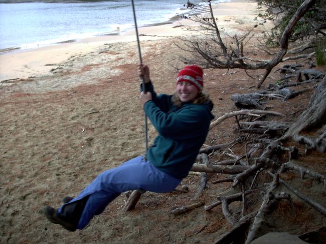
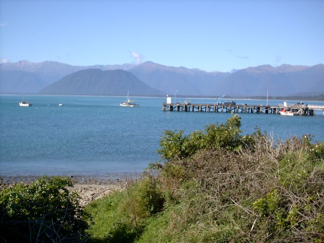
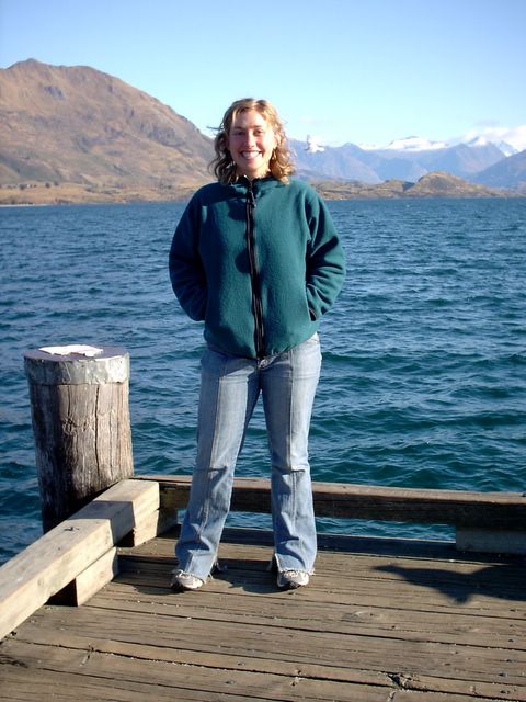
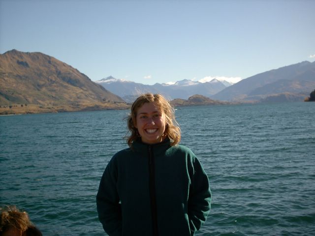
After our evening in Queenstown (including a lovely meal at an Indian restaurant), we woke up the next day, ready to head off to the West Coast and the Glaciers. I hopped behind the wheel and off we went. There was a little more involved than that, but I'm sure you guys don't need to know our entire morning routine. It is fairly standard stuff! We drove up through Wanaka and on through the Haast Pass, one of only three roads connecting east coast and inland parts of the South Island to the West Coast. There are only 4 million people in the country of New Zealand, 3 million of which live on the North Island. That leaves only a million on the South Island. About 350,000 of those live in Christchurch, the South Island's biggest city, leaving only a little over half a million people to inhabit the rest of the Island. Between the population centers of Nelson (52,300), Dunedin (110,800), and Invercargill (49,300), that doesn't leave much of a population for the rest of the island, especially the West Coast. Greymouth is by far the largest town on the West Coast, with 13,500 people. The next largest towns are Westport, with 4,845 and Hokitika with 4,000. And that's about the extent of the large towns. The rest are small settlements spaced out along the one highway that runs along the coast. An Austrian guy at one of the West Coast hostels made an interesting observation about New Zealand. He noted that here, if you are from a town of 6,000, you expect that people have heard of it. In Austria (and the rest of Europe and North America), you'd count yourself lucky if anyone had heard of your town of 6,000, let alone if they had any idea where it was. He's quite right, actually, although I think that applies more to the South Island than the North. A town of 6,000 here is actually quite large. Anne flew out of the airport in Hokitika, which has only its 4,000 people, but that population of 4,000 makes it large enough to warrant a regional airport!

So I started talking about all this because I was going to tell you about the fact that there are only 3 roads connecting the entire West Coast of the South Island to the rest of the island. The West Coast has a range of mountains rising almost directly from the sea, separating it from the rest of the island. This makes road routes between the coast and inland areas difficult to build, maintain and traverse. And with such a small population on the coast, it doesn't seem that they need more roads to connect it to the rest of the island. The West Coast is often considered a bit of a frontier area in New Zealand. Because of its geography, it is essentially cut off from any regular contact with the rest of the nation. Last week, I saw a story on the news that the only dentist on the West Coast had finally retired from his practice in Hokitika with no one to take it over. Now people will have to drive a minimum of 2 hours, depending where they live and road conditions, to reach Nelson, Christchurch or Queenstown. Most people will have closer to a 4-5 hour drive for their dental care.

The population on the coast may be small, but the land area is big; if you look at a road map, you'll notice how spread out the three passes are. Its hard to find a direct route anywhere in New Zealand, so having to choose between only 3 roads to get to a stretch of highway 550 kilometers long (the longest region in New Zealand according to a West Coast tourist brochure), doesn't seem like anything out of the ordinary. That's definitely part of the charm here. And compared to the vast expanses of the United States, everything is so close together anyway, that it doesn't really matter if you aren't taking the most direct route.

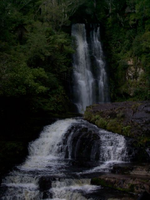
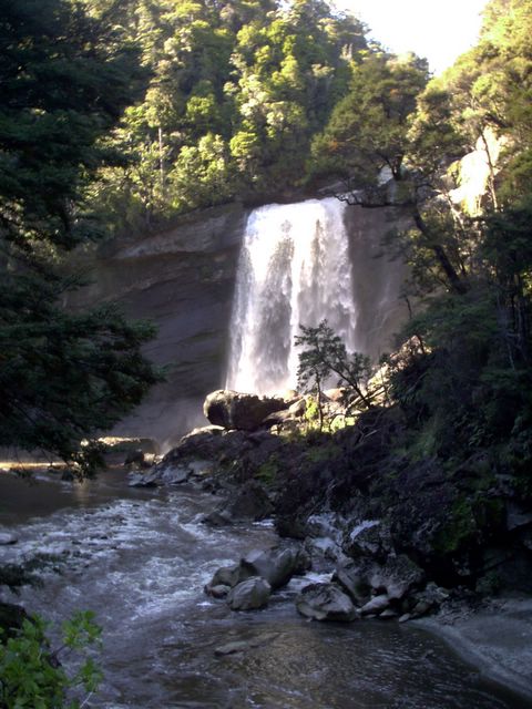
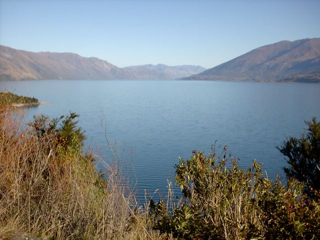
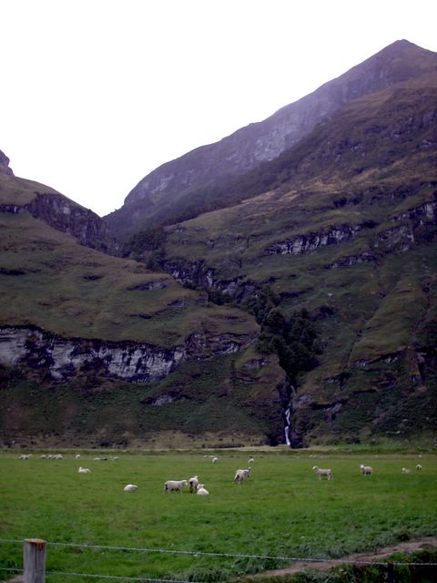
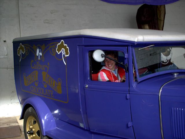
So, we chose the Haast Pass, the southernmost route between inland South Island and the Coast. It is also considered to be an incredibly beautiful pass, which I would have to second. There were multitudes of places to pull over along the way to see various waterfalls, mountain vistas and take short walks into the bush. One place we stopped was called Thunder Creek Falls. Oh, just to warn you all - here comes another tangent. I think a lot of you know about the International Underwear Collection that Meredith and I have going on. We try to collect underwear from as many countries as we can around the world. Its a perfect souvenir, if you think about it. Its useful on a regular basis, doesn't cost too much normally (although that's where this little tangent is heading off to...), and every time you wear them, they bring back memories of all the different places you've been or stories you've heard from your travelling friends who bring you cute undies from their various journeys. One brand of underwear that they have here is called Thunderpants. hahaha. Play on underpants, get it? I thought that was pretty cute. Who wouldn't want a pair of Thunderpants, afterall? Gives you the power of thunder all day long when you wear them. I bet you'd feel like Wonderwoman with her lightning bolt undies (I had those too, but unfortunately I've outgrown them). Just in case you were wondering, I started thinking about Thunderpants because of Thunder Creek Falls. I figured I'd better mention that in case you missed the connection. Sometimes my mind works in its own unique ways. I was taking a look at some of these thunderpants and after taking a closer look at the price sticker "that can't really be the price, can it?!" I decided that thunderlicious undies were not worth $24.95 a pair. I can make my own for quite a bit less than that. But that is nothing compared to the pair of Diesel undies that Anne and I were admiring at a shop in Queenstown. They had laces up the back and were really cute, but cost - you'll have to excuse my lapse of memory here - either $99.95 or $109.95. Can you believe it? Either way its ridiculous. Can you imagine spending $100 on a pair of underwear??? Yeah, they were cute, but jeez...

So back onto Thunder Creek Falls. The falls themselves were pretty. Standard waterfall stuff. Its what happened afterward that was notable. We pulled out of the parking lot after viewing the falls, following a family with a mother, a father and 2 young boys. The father was driving their deep red sedan, probably a rental car, since they looked like tourists and were stopping at one of the major tourist sites along the Haast Pass. We didn't think anything of it. We only noticed all this because we were following them out of the parking lot. It didn't take long before Anne and I were gasping and staring at each other in disbelief; this man was the most horrendous, dangerous driver we had ever seen! For starters, I don't think he was used to driving on the left side of the road, because he kept switching over to drive on the right. Not just creeping over the line, which would be understandable since it takes a while to get used to the new perspective about where you are on the road when you start driving on the other side. No, he was driving fully in the other lane on a 2 lane highway with a 100 kilometer per hour speed limit. Not so good. Especially with your 2 young children in the back seat. To make matters worse, his reflexes about getting back into the left lane when he spotted oncoming traffic were not as quick as one might hope they'd be. We'd see someone coming at us from quite a ways off, and he wouldn't change back over into his lane until just before they reached him. We'd be on the edge of our seats, both yelling at him to get back in his lane. Of course, its that useless yelling that you do at other drivers, knowing full well that they can't hear you as you are driving along on the freeway following along behind them. But it makes you feel better to get it out there anyway. Normally, following him at a safe distance would mean leaving a few car lengths in between us, but I think I was leaving double that, because he was making me so nervous with all these near misses that I didn't want him to get into an accident and come hurtling back to run into us as well. So I figured I'd better leave extra braking space in case he got into an accident. A LOT of extra space.

Did I also mention that he was going insanely slow? And yes, I have to admit that Malea is correct that her grandmother probably drives faster than me, so you know that if I was getting impatient with him, he was REALLY going slow! After a little while of watching him drive like this, we were both nervous about following behind him, so I decided to pass. I pulled up close behind him, to signal that I wanted to pass him at the next opportunity. Well, we came to a straight section where I could pass and he just took off! He must have some buried dreams of being a racecar driver, because he was going probably 120 kms/hr! Remember this is a 2-lane mountain highway, not a 4-lane American interstate. I wasn't about to pass him at that speed, but I figured if he was going to speed up, at least I wouldn't get quite so frustrated being stuck behind him. Unfortunately, his racecar driver dreams didn't extend to the next set of curves. As soon as we were back to the curvy bits (as most of the road was), he was back up to his old tricks, weaving back and forth across both lanes, going unbelievable slowly. I was driving along, all tensed up, eagle eyes on the road ahead for ANY possibility of an area in which I could pass. We had a laugh about the idea that I could probably pass the guy on the left, just continuing along in my lane, as he was taking one of those curves in the righthand lane; I didn't think that would be terribly safe though. ;) It would be a funny story afterward, but probably one of the stupider things I could do while driving a car. So I managed to restrain myself.

So there we were following close behind him, waiting for any opportunity to pass, constantly being foiled on the straightaways as he transformed into Mutant Racecar Driver, and then being stuck behind him all over again on the curves. Eventually, it got to be too much. I slowed down to leave a good chuck of room between us again. As in, let him go WAY ahead, so I wouldn't have to even watch his bad driving ahead of me, constantly reminding me about how much I wanted to pass. Just at this point, another car came up behind me. I think they were a little confused about why I was going 70 kms/hr on a straightaway, but they passed me and went on with it. Well, until they reached Bad Driver Man. At this point, we abandonned our idea of getting so far behind that we wouldn't be able to see him, because we couldn't pass up the opportunity to watch and laugh as they went through everything that we just had. They got up close behind him, signalling their intent to pass just as we'd done. And then the fun began. We could see them pulling out a little, looking for passing space on the road ahead, hitting the brakes every few seconds as Bad Driver Man changed his speed, and lane, arbitrarily on the curves. We felt their excitement along with them as we saw a straightaway approaching, but we knew more than they did, and we were laughing because we knew they wouldn't be passing. And sure enough. Bad Driving Man became Mutant Racecar Driver and sped off up the road, and we could imagine the surprise and confusion amongst the passengers of the other car as they belatedly speeded up behind him. Unfortunately, their reaction time wasn't quite fast enough to pass before he slammed on his brakes as he reached another set of curves. They went on like this for maybe 10 minutes or so, Anne and I laughing our heads off at the whole spectacle, realizing that we'd looked just as silly before, too. These guys had a bit more luck, or guts, than we did, however, and managed to pass him after 10 minutes or so of failed attempts. They roared off up the road and we could picture the dialogue going on in their car. Probably quite gleeful, with some fist-shaking goin' on. And I'm guessing many of the words they'd use to describe this man's driving were not ones I'd want to write here.

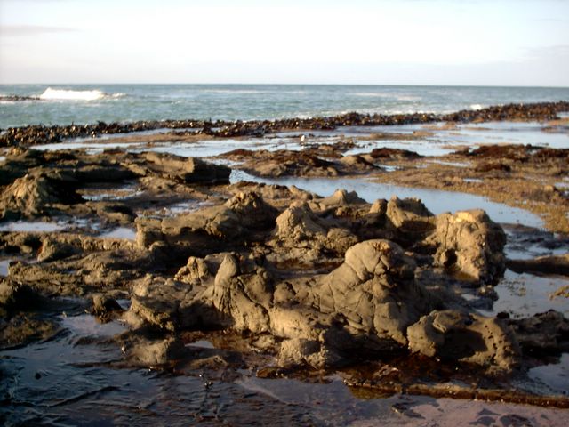
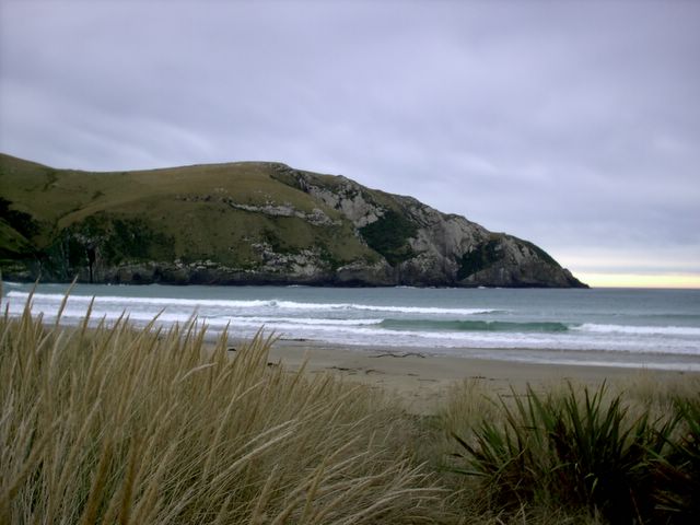
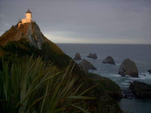
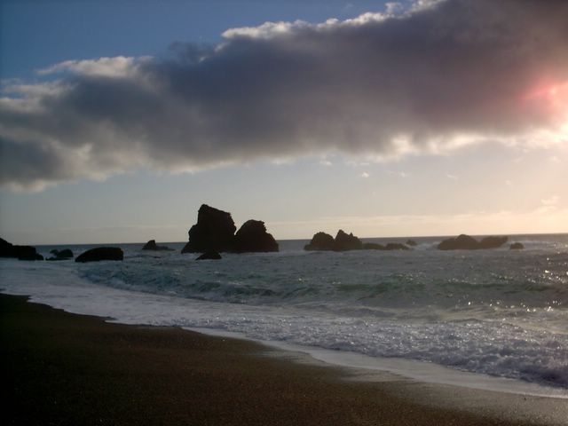
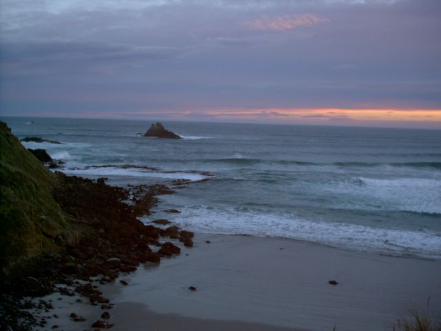
We dropped back again at that point, and pulled over for petrol soon afterward when we reached Haast, taking our time and putting plenty of room between him and us. We continued up the Coastal Highway to Fox Glacier, stopping at several lookouts along the way, such as Knight's Point, one of our first views of the rocky, wild West Coast coastline.

Saturday, May 07, 2005

Kayaking Milford Sound

I already put up some photos of my kayaking trip through Milford Sound, but I'll just tell you a little bit about it, since the photos of course can't tell the whole story. And neither can I in this little space either, but it will be a good supplement, I hope. We started off a little after 8 in the morning, Anne being whisked off with her group and me being picked up with mine a few minutes later. We went down to the waterfront, where all of my planning of gear and clothes to bring was quickly deemed irrelevant, since we were given an entirely new set of clothing, from long underwear on up. We stripped down there amidst the fishing boats, gratefully putting on the thermals and other layers provided to us. Lets see if I can remember them all: thermals, neoprene vest, waterproof jacket, life jacket, spray skirt, fleece winter hat, sun hat, and a polarfleece to bring along in case you got cold and wanted another layer. Whew! I think the only things that I packed that I actually brought along were my cameras and my lunch. Oh. And sunscreen, of course. We got all trained in about what to do if you tip and all that jazz, and then we hopped into our boats and headed off. Meredith, you would have been excited about our whole fleet of Amaruks. I thought of you and your Amaruk love as I admired all their graceful lines and bright colors against the dark water and stark mountainsides of the the fiord. We had a sunny day for our kayaking, which was quite exciting. It had been a while since they'd had a good rain, and our guide, Will, was amazed at how clear the water was since it hadn't been stirred up in so long. We could see anemones, fish, sea urchins and even a sea cucumber under the water as we paddled beside the cliffs. And a fur seal popped up not 10 meters from the kayak that I was paddling with Peter, eating a fish! I think you've all guessed how excited I am about the seals here, so that was special. I hadn't seen one eating yet. We also saw Bowen Falls, which was quite the impressive waterfall. Our guide pointed out Sterling Falls off in the distance, which looked only a kilometer or so away, but was actually 8 kilometers off. I think the scale of the peaks throws of my perception of distance. It is hard to imagine anything quite that massive, so I underestimate their heights and distances. We passed Mitre Peak, which looked to me like any of the other peaks, but it is a famous one. I guess because it looks like a Mitre, thus the name. A Mitre is a hat that some of those Catholic guys wear. I think maybe its the bishops. Will also told us the Maori legend of how the fiords were created. Tui (I am guessing on spelling here), the god who was a tatoo artist, was chosen to create the 14 fiords along the southwest coast of New Zealand. He started at teh bottom and by the time he'd arrived at the top and created Milford Sound, he was so well practiced, that he had perfected his art and created the perfect fiord. By the way, Milford Sound is misnamed. A sound is a valley carved by a river (which usually ends up being V shaped) that sinks below sea level and fills with sea water. A fiord is a valley carved by a glacier (which is usually U shaped) that fills up with seawater. Fiordland National Park is all fiords, including Milford Sound! Basically, we had a wonderful day cruising around, just being amongst the mountains, being impressed by the steep mountainsides as they dropped down into the ocean and admiring the trees who are able to hang onto them. We did have one little adventure, when one of the cruise ships sent up big waves from their wake as they passed near by us. We did as we were supposed to do, paddling into it and then backpaddling to let ourselves ride over it, but I don't think it quite worked. I also think that the spray skirts were only designed to keep out spray, not enormous waves washing over top of our kayak. I guess I gasped a bit as all that cold water gushed into my seat, because Peter asked whether I'd gotten too wet. I told him I was sitting in quite a bit of water, but no worries. it wasn't as if it was enough to swamp us or anything, obviously. When we got out at lunch, we pulled up on the beach and I was in front, so I hopped out to pull the kayak up further for him to get out and he burst out laughing because as soon as I got up, a whole sheet of water flowed down from my butt where I'd been sitting in that inch-deep puddle. He said he didn't realize that I was serious when I told him how much water I was sitting in from the wave. We all had a nice lunch on the pebbley beach. I ate part of it lying on my front, trying to get the sun to dry out the seat of my thermals a bit. I gave that up pretty quickly though, because if you've ever tried eating crackers loaded up with toppings lying on your front (or your back, for that matter), you will know that it is not an easy task. On our way back, we saw a white heron, a grey heron and a small black shag in the shallow grassy area by the entrance to the harbor. Anne and I both made the bus without incident and had a nice, relaxing ride back to Queenstown. More updates soon...

Keas at the Milford Sound Lodge!

One of my homework assignments that Karin left me with when we were parting after Abel Tasman was to make sure I see a kea while I am here. Keas are mountain parrots, the highest altitude-living parrots anywhere in the world. They are generally described as "cheeky" and are known for being fascinated by human-manufactured goods, ripping them apart with their beaks in their attempts to figure out exactly what the thing is. They have a loud, hoarse, call that sounds like they're saying "kea." Thus, the name. They are so funny. They're such little thugs, flying around in gangs, vandalizing all sorts of stuff, calling out their "kea"s so loudly that you can't miss them as they fly over. I finally got my chance to see a kea, or rather, a flock of them - I don't think they often hang out solo, I always see them in their gangs, er, flocks. I was awakened pre-dawn from my bed in the Milford Sound Lodge to the cries of a flock of keas outside the hostel. I was still a bit groggy and tempted to stay in bed. Of course, it didn't take long for me to decide that of COURSE I wanted to go out to see the keas. So I grabbed my headlamp and my fleece and stumbled my sleepy self out of bed and out the door, remembering to unlock it before closing it - I wasn't sleepy enough to forget that major point. I padded around in the dark, following their calls over to the garbage bins and a cluster of camper trailers out behind the lodge. I could see them in the beam of my headlamp, hopping around on the ground and over the picnic tables and garbage cans, occasionally emitting a raucous, hoarse "kea," just to remind everyone exactly whos territory they were in, I guess. I watched them for a while, just taking it all in. I could tell, even in the dark, that these little characters had a lot of personality. I started to shiver and decided to go back to cuddle up in my nice warm sleeping bag again. Later, after I woke up for real and was heading over to the kitchen for breakfast, I got to see the keas again, cheekily taking over the courtyard picnic tables of the hostel. They didn't seem worried by the close proximity of all the people around them. Afterall, why should they, I suppose. They certainly seem to rule the roost around there, and I for one wouldn't want to tangle with those beaks.

Friday, May 06, 2005

Mackenzie Hut to the Divide - Day 3

We set out on our third and final day of hiking after waking up in the morning, which in my case meant getting up in the morning, since I'd been waking up all night from the cold! But what a sight greeted me! Looking out across the valley to the sun just risen behind the snowcapped mountains, the pink dawn light still illuminating the valley floor and our cooking shelter as I washed my face in the freezing cold water - as if I wasn't awake enough already! But it was all good after a cup of hot cocoa. We got going fairly early in order to leave time to have a nice lunch beside the lake at Howden Hut and climb up the spur trail to Key Summit. We passed through an area called "The Orchard," which is an open grassland with trees scattered throughout. Its an interesting and unusual break in the regular scenery of dense bush and mountainsides. We continued past a well-placed bathroom and Earland Falls. They are 174 meters tall and we walked almost directly beneath them along the trail. Its a powerful experience to walk so close to the base of such an awesome waterfall. I can't imagine at flood levels. They have an entirely separate route that hikers need to take at times when the river is in flood condition. I'm not saying much about the hiking today because it was all nice. That's the best way to describe it. We didn't have the high mountain vistas and ascents and descents of the day before, or the dramatically changing vegetation. But our hike was just so... nice. Peaceful. Zen. We ate our lunch as planned, out in the sun next to the shore of the lake. Granted, even though we were eating in the sun, we still had to contend with the wind and cool temps, so we were wearing winter hats, fleece jackets, windbreakers and such to stave off the chill as our lack of activity left us to battle against the cooling effects of our evaporationg sweat. A couple times we questioned whether it was really the brightest idea to be eating out there, but we decided that it was so nice to be sitting lakeside, that it was worth trying to eat with one hand while keeping the other warm in your armpit. We had done quite well with getting rid of our food by this point. We'd been engaging in that age-old backpacker tradition of decisionmaking for meals based on weight. "What should we have with dinner?" "Well, I think the zuchinni is heavier than the green beans. Lets eat that first." I often found myself, when deciding which type of fruit to eat, holding one in each hand, feeling their weight and eating whichever was heavier. Sometimes it was a hard call, but every little bit helps, eh?! We managed to give one of our carrots away to a couple of the English girls, Helen and Becky, who had been staying at the huts with us for the past two nights. They were grateful for some fresh veggies and we were grateful to have one less carrot to take care of. Win-win situation! We took off up the hill to the Key Summit turnoff after lunch. Luckily I listened to Anne, when she told me that it was still a little ways up the trail before we hit the turnoff for Key Summit. I thought the trail left from the Hut, and was all prepared to leave my pack there. That would have been a pain in the butt to come back for. The turnoff for the summit trail was so funny. It looked like a pack-parking lot! There were packs everywhere, lining the sides of the trail. I got quite the kick out of the the whole scene. We dropped ours as well, found parking spaces for them and headed up the hill. This time it really was a hill. Unlike Conical. At the top, there was an alpine wetland with a signposted nature trail and brochures at the beginning to guide you through it. We had a nice time wandering up there. I love wetlands and a wetland up on a mountaintop - wow! I had never seen that before! We followed along up to the lookout to Lake Marion, a lake situated in a narrow valley between two mountainsides. It is literally two mountains coming together with just a lake in the middle. Pretty cool. We had a laugh about the viewpoint, however, because on our way back down, we noticed that we could see Lake Marion from pretty much anywhere on the trail! We descended back down to the regular trail, saddled up with our packs again and headed off toward the divide. I was walking in front, with Anne following along behind me. I was having some digestive issues after our lunch and startled Anne out of her reverie with my announcement that I was burpy and my burps tasted like sausages. Poor Anne! She was a little grossed out by this, especially when it came out of nowhere to startle her out of her hiking zen. Of course, that made me start laughing so hard that it cured my burpiness at least. We walked the rest of the way out and down to the Divide, timing it perfectly to be there 10 minutes before our shuttle was scheduled to come and pick us up. We were quite proud of having such prompt and well-planned timing. Because after all, who wants to sit down at the side of the road when you could be out playing around in the mountains?! Our shuttle took us to Milford Sound via the Hollyford Track trailhead, where we dropped off several fresh hikers to begin a trek of their own. This was where I just had to laugh as I saw the 100 kph speed limit signs on the gravel road. It was a good gravel road, but not THAT good! Milford Sound. We arrived at the Milford Sound Lodge after a scenic drive along the Milford Road. We checked in and showered, unpacked and generally made ourselves feel better. We booked kayak trips for the next day, which was quite the feat, in and of itself. We ended up getting the last two spots available for any kayaking trips the next day. Unfortunately, we were on different trips with two different providers, but at least we were both going kayaking. And turns out that we both got a buddy to kayak with because I had Peter, the guys we'd met on the Routeburn, on my trip, and Anne had Anna, our roomate at the Milford Sound Lodge, on her trip. We had a fun night relaxing and cooking a nice dinner with Peter. Well, Anne and Peter cooked and I spent my time trying to get ahold of the bus company to book spots on the bus back to Queenstown the next afternoon after our kayaking trips. For some reason, we weren't having the best luck with getting ahold of people - first the kayaking, then the busses. Intercity Bussing is amazingly difficult to reach for being such a major transportation company here. But it worked out well. I got tickets (fairly cheap, at that) all booked and paid for. Anne and Peter cooked up an excellent dinner of multiple courses: smoked cheddar and spicy thai tuna quesadillas for the starter and a pot of our remaining noodle packets and vegetables spiced up with a little of the grated smoked cheddar for the main course. After this, we hung out and I played "speed scrabble" with Peter, which I won. Barely. To top it off, I had to tell a story or a poem using all the words in my collection. It was quite the interesting story, due to the rather unique words I had to work with. I think my favorites were 'slap' and 'reiki.'

Day 2 o' the Routeburn

So, after waking up and getting all packed up in a light mist of rain, Anne and I had some hot cocoa, muesli bars, trail mix, fruit, and a carrot for me, and then we headed off up the mountain. We had quite the climb to do that day. This second day was going to be our longest day of hiking, especially since we were starting out from lower than we'd planned. Although that only added an hour, so it was no big deal. The mist cleared up quickly, and I am happy to report that the waterproof pack cover that I bought for the trip didn't get used once. In fact, I still haven't used it. Which is a good thing. We hiked up, and up, and up. Not all super steep, luckily. We got some amazing views out of the valley we'd been staying in the night before, all the golden grasses surrounded by steep, snowcapped mountains. The Routeburn Falls Hut, situated at the edge of the treeline, where we stopped for a bathroom break, was like the Hilton of huts. They even had a mirror in the bathroom! Can you imagine?! I've always considered it funny when they've had flushing toilets at some of the huts and campgrounds, but mirrors?! That's above and beyond necessary. You're in the wilderness for goodness sake. Maybe its because the water is so clear in the streams that you can't see your reflection, just the stones in the bottom as the water runs over top of them. We continued our hike UP to the Harris Saddle, where we stopped for lunch and a short sidetrip up Conical Hill. The name Conical Hill is actually quite ironic, since it took some of the steepest climbing we'd done so far to reach the top. It was definitely steeper than the gentle grade of the side trip we took up to Key Summit the next day. From their names, you'd think Key Summit would be the hard one, but it was more like a hill and Conical Hill was more like ascending a summit! Anyway, I was very happy that since the track up Conical Hill was a side trip, we could leave our packs at the bottom. I was nervous enough with just myself climbing up those steep mountainsides. I get a little scared of the heights when I'm out and exposed like that. But we made our way through, up to the top, and oh! What a view! This is where I was inspired to twirl around like Maria, taking in the view from all directions, and glorifying in the magnificence of being up there on top of the mountain. Anne and I also took super hero pictures, perched atop a craggy bit of rock, hair blowing back in the wind... hopefully they turned out, because I know when I was shooting the one of Anne, she really did look ready to take off and save the world. Back down at the bottom, we grabbed our packs, and a little more chocolate, and headed off down the track, watching as the snow-capped mountain range to our right drifted in and out of view from the imperceptibly swirling clouds. This part of the track was quite flat, with only slight uphills and downhills, so it was quite fast going. We both got into our hiking zen and just took off! It felt so good to just be hiking along like that, happy as could be, joining in for the chorus of the "lonely goatherd" that Anne would spontaneously break into. After a ways, we could see Mackenzie Hut, our night stop, down below us. About 200 meters below us. So we followed what seemed like an endless series of switchbacks down the side of the mountain. We knew we were getting closer when we reached the forested altitude. That was a good thing, because once we were in the forest, we could no longer see the hut, from which we had been taking heart as we watch it getting larger and larger as we progressed down the mountain. We were getting to be weary trampers by this point, so progress was a good thing. When we arrived there, we were not greeted by the wilderness quiet and solitude that one might expect 4-5 hours into the backcountry from the nearest road. In fact, the private guided walks hut had been rented out by a wedding party, who had arrived by helicopter earlier. They were hootin' and hollerin' and obviously had helicoptered in a fair share of alcohol along with them. It was quite the sight to be walking down the path from the pit toilet in my muddy, sweaty camping gear and moving aside to let through a procession of tuxedo-clad men, accompanying women in evening dresses, carrying glasses of wine as they teetered along the muddy path in their high heels and alcohol-shrouded sense of balance. Here's another funny thing about this hut: the tent sites had green astroturf to set your tent up on. In theory, that might be a good idea, but there was a slight problem in that you couldn't get stakes through it. This might not be so bad, except that the pads were twice as big as they needed to be for a 2-person tent, the standard tent size that anyone undertaking a walk like this is going to carry. My tent, for one, needs to have the stakes in to even stay up, let alone hold the rain fly up and taught. So I was not such a fan of the whole astroturf idea. I ended up, as did others, from the looks of it, setting up my tent on the very edge of the astro turf, so that I only had to get creative on putting in a couple stakes on the astroturf side. Most of them could sink into the ground on the outside. For the inside part, I managed to put a stake under a rock, and hook the rain fly bungy around the top part of the stake, where it curves over. It was quite the set-up and I was just hoping it would last for the night, which it did. That was a good thing, too, because I froze my little booty off that night. The temperatures dropped a lot lower than they had the night before, and while my sleeping bag is good to zero degrees fahrenheit (-16 celcius), I didn't have the 4-season tent to help out with insulation. At least my stake-under-a-rock solution worked to keep out the rain! As I was gnawing away on yet another carrot, trying to get some food in me before dinner and keep myself from getting too cranky at the tent situation (I tend to get grumpy when I'm hungry and tired), I ended up talking to Peter, a guy from Seattle who was also hiking the trail. Here is yet another example of what a small world we live in: the reason he is in New Zealand is that he's doing the student teach abroad program through University of Minnesota - Morris, the same program as Anne! Quel coincidence! I ended up hanging out and talking with him and the Hut Warden for a while after Anne went to bed. How cool is this: the hut warden works in the off-season as a chef in a chocolate shop down in Invercargill (a city down on the southern tip of the South Island)! Yummy. Yet again, I didn't last too long after dark before I headed off to bed though...

The Routeburn Track - Day 1

Alright! Its high time that I got my butt in gear and wrote about all the rest of my travels up to this point. So this is the day. I am totally buckling down and going full-on to get this done! I've been getting further and further behind as I just keep having nice weather and things to do other than sit in front of a computer for hours on end. But not today! Today I write! So, 'bout that Routeburn tramp... No, sillies, there were no sleazy women hanging out along the trail, that's just what hiking is called here. Beginning the track with heavy packs. We started out on our way to the track early Monday morning. I left my car parked next to our hostel, hoping they wouldn't plan some unannounced street cleaning for which they'd tow cars parked in the wrong spot while we were gone. We hopped onto the track shuttle bus that continued around to several more hostels until we had a full load of us and then we took off up the road along the shore of Lake Wakatipu, all the way to Glenorchy, at the tip of the lake. From there, we continued on, passing the road to Paradise, up to the start (or end, as the case may be) of the Routeburn Track. Now, I know all sorts of serious backpackers will cringe at this confession, but I have to admit that I'm a big fan of eating fruits and veggies when I hike, so I'm willing to take on a little extra weight to have decent food that leaves me feeling happy during my trip. I usually manage to keep the extra weight reasonable, but somehow, our food load for this trip ended up over on the ridiculous side. My pack was so heavy! I have no idea how food and supplies for 4 days could weigh that much! I didn't bring any books other than my journal. I only brought one set of clothes for hiking and another warm, dry set to change into at night. My tent is not extremely heavy. Nor is my sleeping bag. And that's really all I had. Plus cameras and binoculars. I don't know. I still blame it on the carrots. I found myself eating a lot of carrots. Or should I capitalize that? A LOT of carrots, due to a little misunderstanding at the grocery store. I asked Anne whether she wanted a carrot each day for lunch. She heard did she want A carrot for lunch. So she said yes, and I dutifully grabbed enough carrots for each of us to eat one for lunch every day, plus an extra one to have with our pasta dinner one night. Anne assumed that I wanted all those carrots for myself and didn't say anything about the amount I was buying. It wasn't until we got on trail and had our first lunch and she said that she didn't really want a carrot that we figured out that she doesn't even like carrots! So now we had 9 carrots, a rather heavy vegetable, which seemed all the heavier, now that we realized that they'd take a lot longer to eat than originally planned. So I went to work. I ate them for lunch and snacks. We put half of one in the pasta dinner and I ate the other half. I ate one for breakfast. We even managed to give one away. The carrots turned into one of the jokes of the trip. "Packs are heavy, better eat a carrot!" Only when all was said and done and we arrived back in Queenstown, congratulating ourselves on how we'd eaten almost everything we'd packed, did Anne admit that she'd never eaten a single carrot, other than the half a carrot that we'd put in the dinner our first night. That means that I'd managed to polish off 7 and 3/4 carrots in the span of 4 days. These were big carrots, too. Luckily, as you can see from our photos, I didn't turn orange, although sometimes I felt like I was going to. Routeburn Flats Hut. So, we started out on our hike with those heavy packs. And, oh, the scenery was beautiful! The track follows the river for the first part of the hike. Burn is a Scottish term for river, so Routeburn literally means the route along the river, not terribly creative, but at least its descriptive. So we were hiking through mossy beech forests, with views of the beautiful, clear stream running down in the gorge below us. We stopped at a rocky beach beside the river for a break. I was looking at the map and realized that there was a tent sign at the Routeburn Flats Hut, but not the Routeburn Falls Hut where we were staying. Well, where I thought we were staying... I had booked my trip after Anne, and I originally booked to stay in the huts with her, but after finding out the prices, I called back the next day to switch to tenting. Well, the woman who helped me was very nice, but not very informative, I discovered. For starters, she didn't mention that when I switched from hutting to tenting, that I'd be in an entirely different site for the evening. We discovered this only after I looked more closely at my ticket. Oops. We decided to ask the Hut Warden if Anne could switch to stay in this hut instead of the one that she was booked into for the night. That was when we also discovered that Anne and I weren't supposed to cook together since I was tenting and she was hutting, unless we used my cooker, which we hadn't brought, since we thought it would be easier to use the ones in the huts. This was a different rule than other great walks huts. Oops again. Don't worry - it gets better from here. Better in that things stop going wrong, not funnier stories - sorry. So it was now around noon and we'd already reached our final destination for the day. Hmmmm. Well, we broke out the lunch fixings and had ourselves a nice lunch of crackers, pita, cheese, sausage, tomato, fruit and the first, infamous carrot of the trip. Then Anne took a nap and I went for a little birding hike around the area, using the ginormous bird bible that the Hut Warden loaned me. I saw a rifleman, a tomtit and a robin, which is entirely different from our robin at home. It is all grey. No orange breast! So that was neat. When she woke up, we both took a little wander around, hung out by the stream and talked. We watched a helicopter land at the hut when we were off, so we obviously headed back to see what that was all about. Not that we're busybodies or anything, but you can't help but be curious about something like that. Nothing too exciting though. Just a supplies run and dropping off a DOC worker to cut out the raspberry brambles. We had a fun evening hanging out with the other 3 people staying at the Hut. I really think that one of the greatest things about tramping is all the cool people you meet. I went to bed shortly after dark and slept 11 hours until I woke up at 7 the next morning. Yay for camping sleep schedules!